Between Dingboche and Lobuche.
Part I
Part II
Part III (you’re on it!)
Part IV
And the Everest adventure continues! We’re going to make it to Base Camp this time! This leg of the trip is most seared into my brain, so get ready for some dramatic, verbose writing! So after two nights in Dingboche, it was time to leave for the very tiny village of Lobuche. We packed up and took the same route we had the morning before for the day hike.
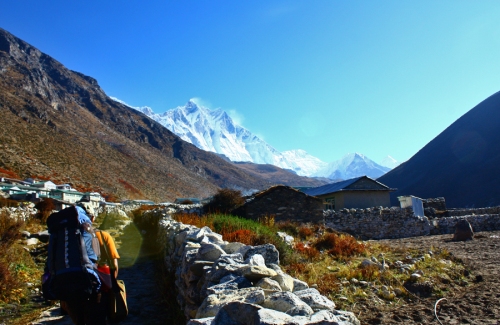
Taken about a minute after we left.
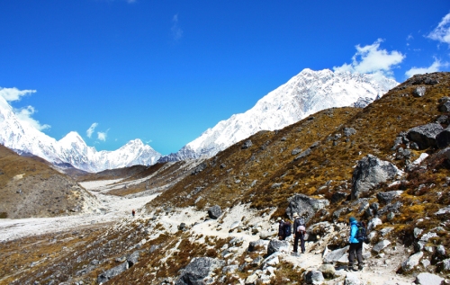
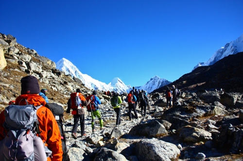
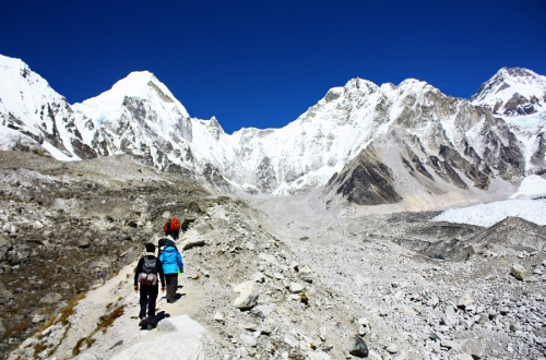
We retraced our steps about halfway up the mountain nearby and then turned off on a path that was being guarded by a pair of very lazy dogs. (They weren’t really guarding anything; they were fast asleep in the sun).
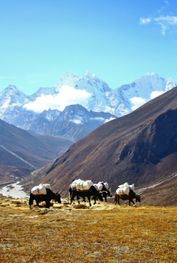
We were immediately treated to more breathtaking views of the surrounding mountains. As you can see above, we were not the only party on the trail. We passed some dzopkyo going about their business.
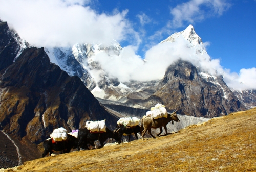
I know how they feel, struggling uphill.
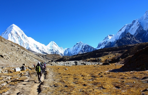
The initial trekking was pleasant enough, as it was on even(ish) ground without many rocks. We got a view of the town of Pheriche from above.
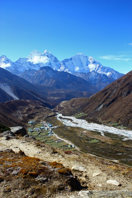
See those little fields and buildings below? Pheriche!
There will be more on Pheriche later!
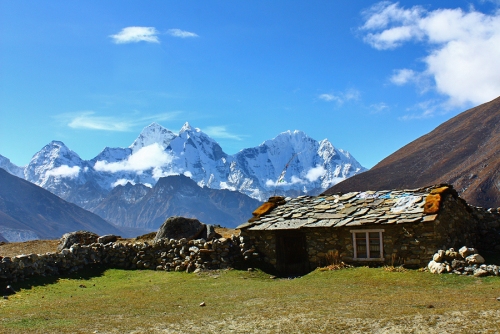
We also passed this adorable little abandoned(?) cottage. After a good dose of walking across an open valley plain, we veered onto a path that wound around the side of a mountain. After more demented ribbon candy path trekking, we crossed a bridge over a channel of water and then had to climb back up. This is when things began in earnest.
(A note now, though, on my pictures of the trails. I’ve noticed that my photos of the trails tend to feature a lot of flat and even paths that don’t look terribly difficult. You must be thinking “wow, this girl is a complaining drama queen.” While that may be true, I didn’t manage to get pictures during the more difficult times on the trail because I was trying (a) to not fall over or (b) to not cough up a lung. The more difficult zig-zagging parts of the trail were also not particularly picturesque.)
So, when we began to climb back up from the bridge, the climbing became far more rocky and difficult. It was also suddenly intensely windy and freezing. This also marked one of the last sightings of these along the trail:
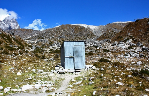
Here we see a toiletus sheet-metalus in its natural habitat.
A note now on the toilets. Do not go on this trip if you cannot deal with bad toilets. And I mean bad. The toilet pictured above is actually pretty nice. I won’t go into the gory details, but most toilets on this journey consisted of a hole in the ground and squatting in cold and dark places. I will say that you do get used to it and once you return, you have a new found appreciation for Western toilets and indoor plumbing (at least I did).
After a fairly brutal upward climb, we reached a field filled with memorials:
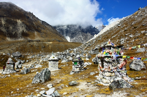
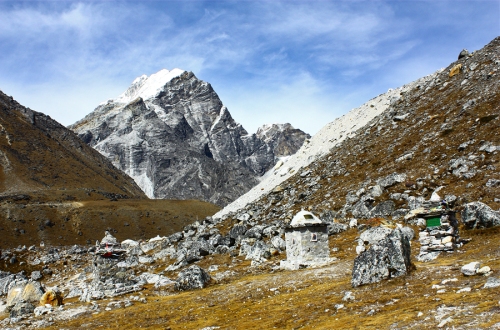
It was fairly sobering. These were all memorials dedicated to men and women who had died on Everest, either summiting or, in at least one case, on the trail to Everest Base Camp.
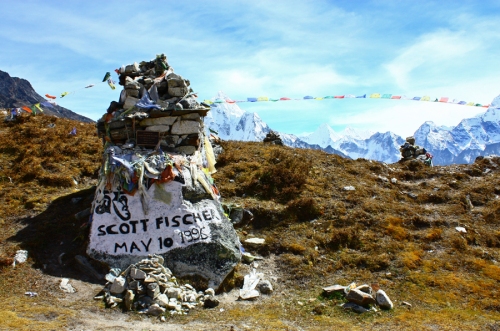
I immediately recognized this memorial, of course. Scott Fischer was one of the casualties in the 1996 Everest disaster and a main character in Jon Krakauer’s book Into Thin Air.
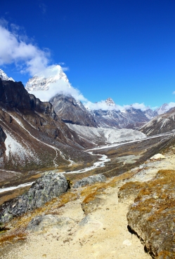
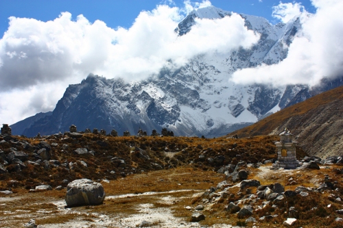
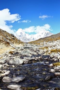
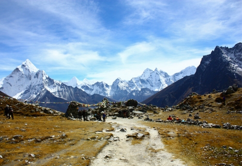
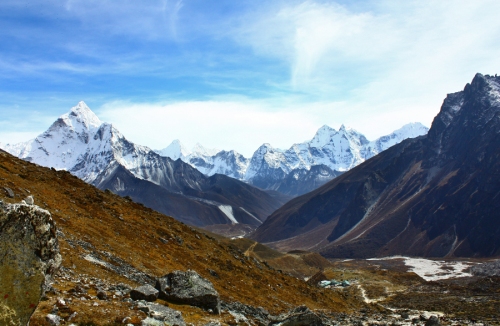
After a rather somber break, we continued on towards Lobuche. The trekking at this point was far easier (although rocky) and, in my opinion, one of the most beautiful days.
This is the view once you leave the memorial field.
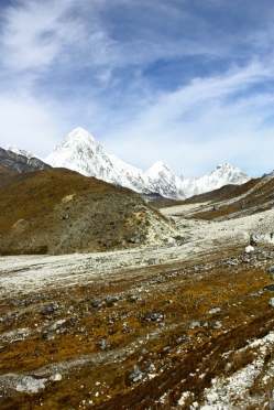
This was probably my favorite stretch of trekking. I cannot describe just how beautiful it was in person. The pristine white mountains in the background absolutely glowed.
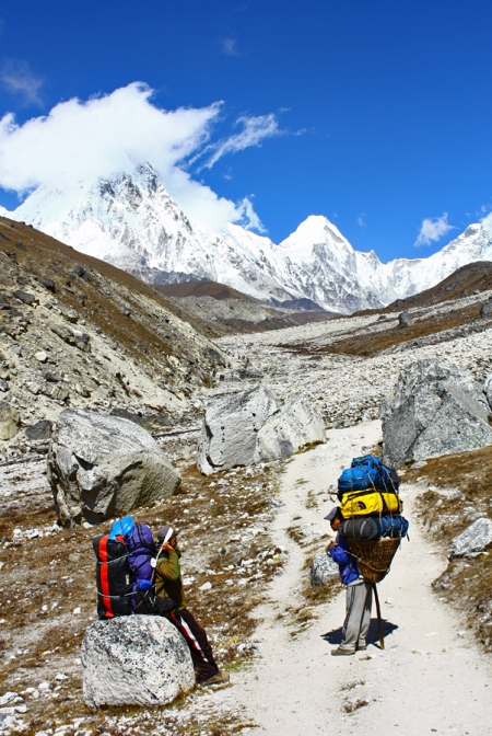
Here are two porters with colorful bags having a conversation. I genuinely admire how hard working these guys were. I can’t imagine carrying all that baggage!
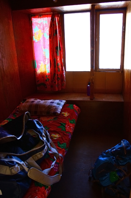
And so, after about an hour or so of walking among the bleached rocks towards those mountains, we reached Lobuche. We did not stay in tents at Lobuche because it was so cold. We instead stayed in a lodge. Well. To put it politely, I was not a fan of this lodge. I genuinely believe that the construction was overseen by the Joker. It was constructed entirely of thin plywood, and nothing fit together as it should have (including doors and door frames). The long hallway to the bathroom was dark and Kubrickian. It looked like the set of a horror movie, and I honestly would have preferred sleeping in a tent. It didn’t help that I was tired, sick, freezing, and struggling to eat anything.
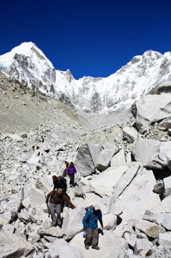
The next day was better. We left Lobuche bright and early with everyone else in town.
This should disabuse you of any ideas of being alone on the trails.
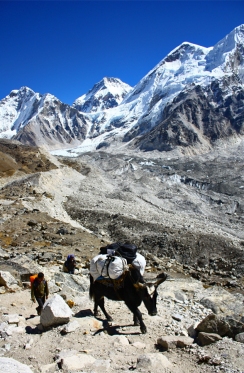
We were headed now to Gorak Shep, the last small outpost before Base Camp.
The initial trekking, as you can see above, was not so bad. It became more intense as we went on.
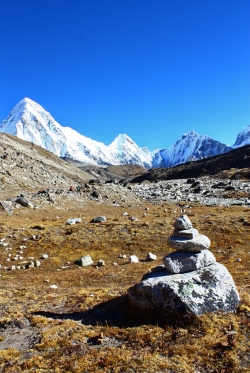
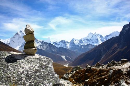
Stacked rocks on the beginning of the trail to Gorak Shep and a dzopkyo near the end of the trail.
Towards the end of the trail, I heard a loud rumbling and looked off into the distance to see this:
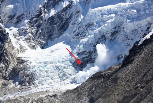
An avalanche! Thankfully, this was nowhere near the trails and therefore no one was hurt/in any danger. After about 3 or 4 hours of trekking, we reached Gorak Shep.
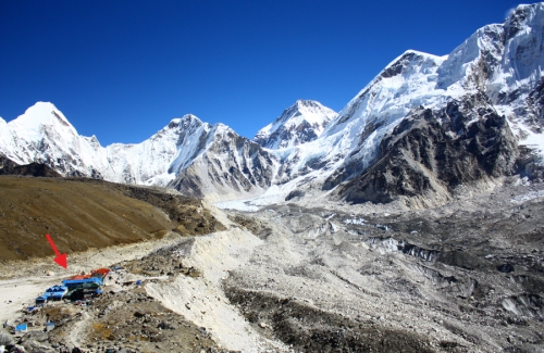
You can see how tiny the village is in this photo from the trail. It’s not much bigger closer up…
All of the buildings looked brand new!
You might be thinking “ah, you reached Gorak Shep! Good for you. Surely you then rested for the remainder of the day?”
HA! No. After reaching Gorak Shep, we ate a quick lunch and then pushed on to Everest Base Camp. This was the absolute most intense part of the entire trek. We were all freezing and exhausted. Two of the four of us had to have the sherpas carry our packs (I did not).
It was like trekking on the surface of the moon. There was almost no vegetation. The path to Base Camp was also the most treacherous, with an incredibly uneven and rocky trail. As a result, I spent most of my time forcing myself along and trying not to fall over. Because of my lung infection, I spent all of our rest breaks coughing nonstop (for whatever reason, if I was moving, I was too busy trying to breathe to cough). I didn’t take a huge amount of pictures along the way.
At this point, we were at approximately 17,500 ft above sea level. It’s difficult to describe the challenge that such high elevation and thin air brings. Even with Diamox (a medication to prevent altitude sickness), you struggle to find an appetite, to sleep, and to exert yourself. Physical tasks that would be simple at sea level are now serious physical exertions. You have also spent the past nine days or so getting to this point. That level of fatigue drains you. And in my case, it hurt my damaged lungs to breathe in such cold air. You really have to keep a positive attitude and push yourself to get there.
This was the final ridge we walked along to reach Base Camp. (Descending from this ridge, however, there was still more light rock climbing to be done before you reached Base Camp…it wasn’t just a direct trail there). From this ridge (but not visible in the picture) you could see Base Camp. If you looked down from the ridge, you could see glacial lakes.
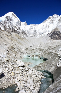
On the picture to the left, you can see the glacial lakes from the melted parts of the glacier. Note that all of this trekking was on the Khumbu Glacier. Beneath the rocks, you could see ice. To the right are the rocks you must climb up and down on to reach Base Camp. Your trekking poles won’t help you here (though I didn’t use any, so they never helped me).
Finally we reached Base Camp! *Trumpets sound*
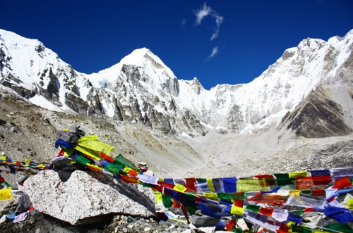
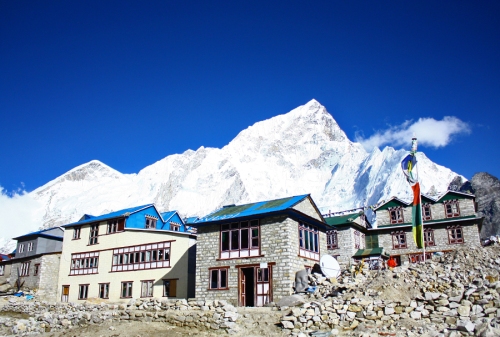
There really isn’t very much at Base Camp. There were some prayer flags (as you can see above), a biting wind, and fellow trekkers who looked like they could be on the cover of Fit Young Hikers magazine. But it was incredibly gratifying to know that I had made it. In something of an exhausted daze, we retraced our steps and made it back to Gorak Shep, where we also stayed in a lodge due to the freezing temperatures.
Not the Hilton, but far nicer than Lobuche!
I woke up the next morning to a complete frost on the inside of the window. During breakfast, it was decided that two of our group members would be helicoptered out and taken to Kathmandu because they were so ill. After that rather grim news, the rest of us quickly began our descent down. We took the same path as we did on the way up. Because we were descending and entering more oxygen-rich air, it went much quicker. We stopped for lunch in Lobuche (where I happily watched the proprietress of the tea lodge knitting a hat) and continued our way down though the memorial field.
The memorial field on the way down.
This was the view from our descent from the memorial field. We used the path that we had taken from Dingboche to Lobuche. However, once we reached a certain point, we turned and descended down instead of continuing on to Dingboche. After about an hour and a half of walking on a loooong rocky field (I almost tripped about five times), we reached the small town of Pheriche (remember the picture at the beginning of this entry?). We tented down and enjoyed a nice afternoon tea.
While reading a book in the tea lodge, I looked outside and noticed that the sun was setting. It was absolutely freezing out, but I’ll do almost anything for a photo. I ran outside and took photos until my hands were numb.
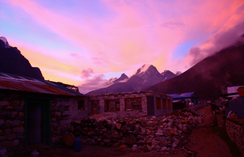
Like most places along the Everest Base Camp trail, Pheriche is undergoing a lot of construction!
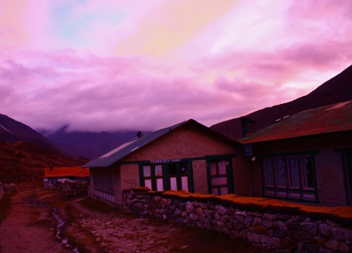
Looking towards the trail out of Pheriche at a Trekker’s Shop.
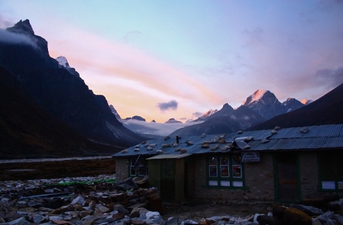
Here is another building that is undergoing construction, with a mountain range in the background.
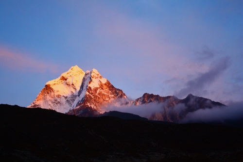
The sunset reflecting off of a peak in the distance.
And so began our descent down. We actually took a different path down than we did going up, so I will cover that in the next entry!